Measure Land Smarter —
Anywhere, Anytime
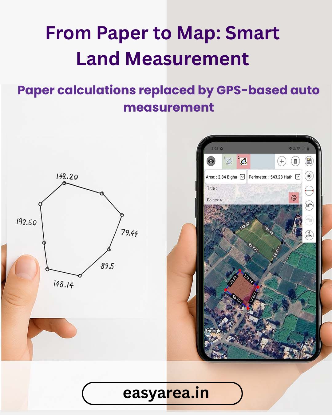
Instant Area Measurement using Map & GPS — All Indian Local Units Supported

Instant Area Measurement using Map & GPS — All Indian Local Units Supported
Join thousands of satisfied users who trust Easy Area for their land measurement needs
Smart scaling technology
No tools required
Works on irregular plots
Farmers, owners, architects
Everything you need for accurate land measurement in one powerful app
Draw shapes on map images and get area instantly with scale accuracy.
All India units: Acre, Bigha, Vaar, Biswa & more + Custom unit support.
Walk boundary using GPS to measure land on-ground in real-time.
Professional tools for farmers, surveyors & property owners
Draw shape on map and get instant area with perfect scale.
Acre, Bigha, Vaar, Biswa, Guntha, Marla & add your own custom units.
Divide your land into unlimited plots and manage project easily.
Walk around land boundary to measure real area in seconds.
Measure multiple plots together and toggle layers anytime.
Import survey files and auto-plot boundaries - zero manual error.